Abhishek and I drove from Boston to California – a trip of a lifetime lasting 4000 miles, 14 states and 4 national parks over 12 days! This is a log of the memories created on the trip!
Our route:
Day 0 - Heading out from Boston
Origin: Boston, MA
Destination: Warren, NJ
Driving distance: 329 miles
States we drove through: Massachusetts, Connecticut, New York, New Jersey
Destination: Warren, NJ
Driving distance: 329 miles
States we drove through: Massachusetts, Connecticut, New York, New Jersey
We started the road trip in late September from MathWorks office in Natick, MA. Abhishek had dropped me in the morning to office, and took the car back to load the remaining luggage. That day was my last day in MathWorks, and I had so many thoughts running through my mind. I could not believe I had been at MathWorks for 3.5 years already, and was remembering many fond memories of my time there, and saying my goodbyes.
Abhishek came by around noon to have lunch. We were heading out from the the office itself. Prathibha, Swetha and Kruthika joined us for lunch that day. All too soon it was time to say goodbye – to MathWorks, to all my friends there, to Natick, and the east coast! And it was time for the next big adventure – our cross country road trip, and the new life waiting for us in California!
Here we are, in the MathWorks parking garage, ready to embark on a 4000 mile journey in our little Corolla! 4000 miles is greater than the sum of the distances from Kashmir to Kanyakumari + Ahmedabad to Arunachal Pradesh! Would the Corolla be able to make it?
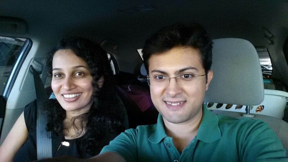
It was really exciting to head off. Abhishek and I were both quite enthusiastic, and raring to go. This trip was Abhishek’s dream ever since he bought his Elantra in 2010!
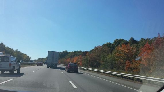 | And we were off! Fall was just peeking out its nose in Boston, and the drive was really pretty. |
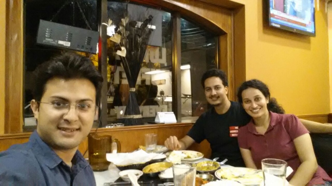
We met Dr. Bahl and his wife in Long Island, NY later that evening. Abhishek was the recipient of the Joan and Lalit Bahl fellowship at UIUC from 2011 – 2013. Dr. Bahl and his wife Kavita Kinra had graciously invited us to their beautiful home.
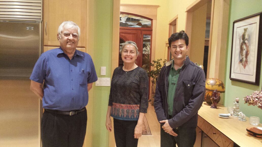
Dr. Bahl had graduated from UIUC, and was with Renaissance Financial after spending many years at IBM research. They are generous philanthropists, and we found them to be very nice people. Abhishek and I were very inspired after meeting him.
After meeting them we continued westward and halted at Somerset Hills Hotel in Warren, NJ for the night.
After meeting them we continued westward and halted at Somerset Hills Hotel in Warren, NJ for the night.
Day 1 - Drive from New Jersey to UIUC
Origin: Warren, NJ
Destination: Champaign, IL
Distance: 830 miles
States we drove through: Pennsylvania, Ohio, Indiana, Illinois
Destination: Champaign, IL
Distance: 830 miles
States we drove through: Pennsylvania, Ohio, Indiana, Illinois
We started out nice and early from Warren, NJ on day 1. We had a lot of ground to cover this day, almost 830 miles, roughly 12 hours of driving. We were planning to see Neeraj along the way in Cincinnati too.
Our car developed a small rattling noise the previous day, which became a little louder the next day. We were concerned – was the car already finding it too hard??
We stopped at a Toyota showroom in Pennsylvania to get the car checked out. We were really hoping that there was nothing serious with the car. I think the road trip gods heard our prayers! The heat vent had slightly bent, and was hitting the exhaust pipe. We breathed a sigh of relief, and set off half an hour later!
The drive through Pennsylvania was really pretty, lots of hills and fall colors along the way.

We reached Cinncinnati around 8 in the evening, and went to an Indian restaurant with Neeraj.
The next day Modi was scheduled to speak at Madison Gardens in New York, and that’s pretty much all we talked at dinner :)
After dinner, it was close to 10, we still had 3.5 hours more to drive to Champaign. We got there around 1 in the morning, and were super tired. I had dozed a bit in the car, but Abhishek had had no respite besides the 3-4 hours I drove, so was a really tiring day for him.
After dinner, it was close to 10, we still had 3.5 hours more to drive to Champaign. We got there around 1 in the morning, and were super tired. I had dozed a bit in the car, but Abhishek had had no respite besides the 3-4 hours I drove, so was a really tiring day for him.
Day 2 - Relax at UIUC
Origin = Destination = Champaign, IL
Distance: 0 miles
Distance: 0 miles
Day 2 we stayed at home in Champaign. We were so glad that Abhishek had suggested this rest day since we had had 2 days of hard driving, and had another 2 coming up.
We had a pretty relaxed day on Day 2. We listened to Modi’s inspiring speech at Madison Garden in the morning, and then discussed it with our families in India for a duration longer than his speech! It was a lovely day outside so we then headed out for lunch and walked around the campus. In the evening we repacked our bags so that we both would only need to use a bag each for the trip.
We also bought some snacks, and got our food basket ready. The excitement of the trip, and the places we were going to see was setting in!
 | The day 2 picture has both Abhishek's old car and my car side by side :) One of few such pictures. |
Day 3 - UIUC to Kansas
Origin: Champaign, IL
Destination: Colby, KS
Distance: 760 miles
States we drove through: Missouri, Kansas
Destination: Colby, KS
Distance: 760 miles
States we drove through: Missouri, Kansas
Refreshed after the break on Day 2, we set out nice and early on Day 3.
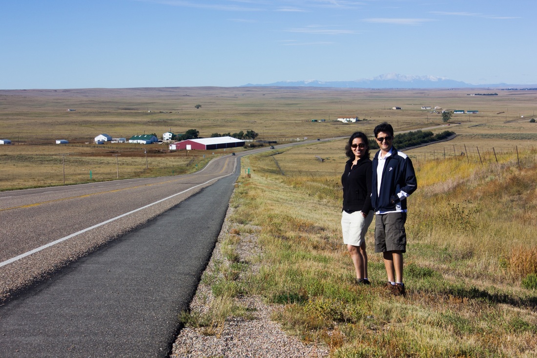
Make sure to notice our skin color now. At the end of the trip, we got at least a couple of shades darker (maybe unrecognizably so? ;) )
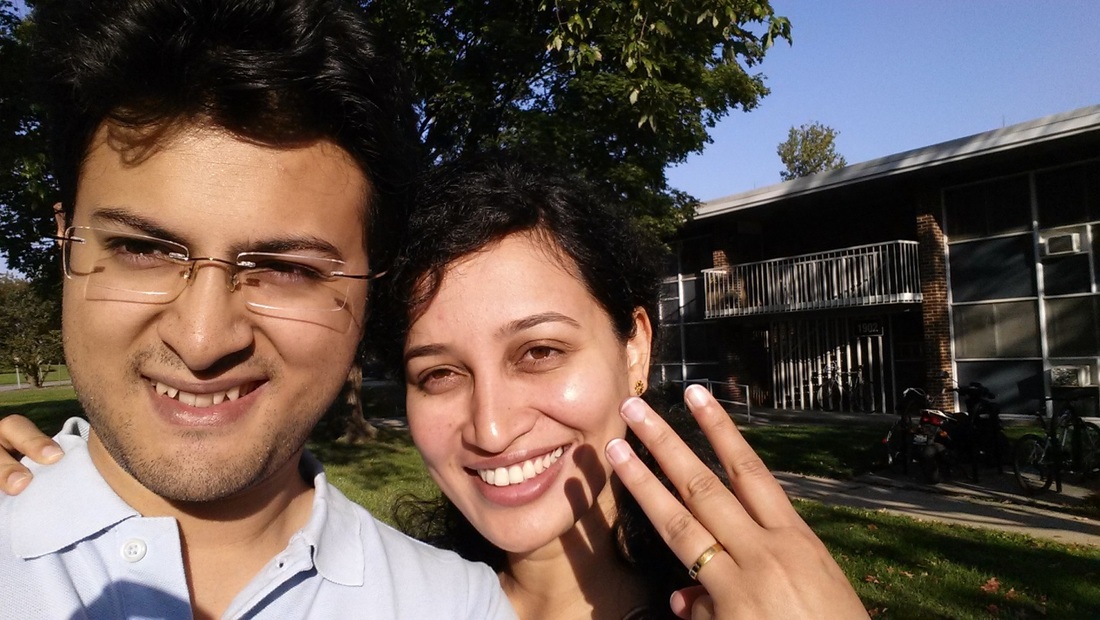
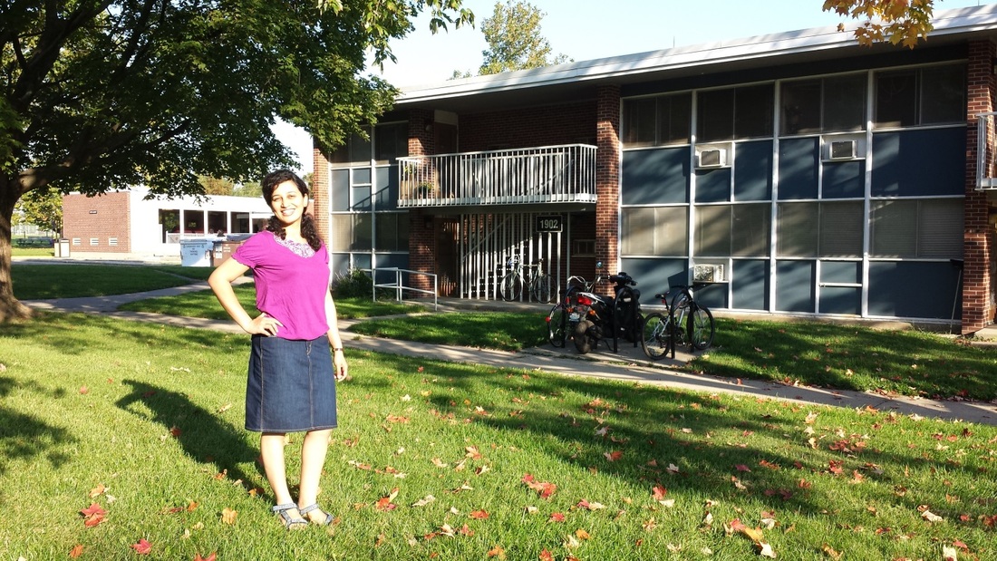
Abhishek’s new digs is in the background. There’s a nice park in the front of the apartment.
Make sure to notice our skin color now. At the end of the trip, we got at least a couple of shades darker (maybe unrecognizably so? ;) )
Abhishek’s new digs is in the background. There’s a nice park in the front of the apartment.
We had a lot of ground to cover on day 3, with almost 13 hours of driving. This was the furthest west either of us had driven, so we were exploring new ground today.
The terrain was quite different from our drive the previous days, which was quite hilly. The terrain around Illinois was quite flat, with corn fields stretching out to the horizon!
We made steady progress throughout the day, having breakfast and lunch in the car itself. Around lunch time we entered Missouri. The terrain started changing again here. The corn fields began disappearing and were being replaced by flat grasslands.
This was quite a sight to see! Most of the time we were on a long straight road stretching up to the horizon and on both sides were flat grasslands as far as the eye could see. This was literally a lonely planet spot – for quite a bit of the way we couldn’t see another car, house or animal in sight! I’ve never seen a sight like this before in my life, especially coming from India, where you can hardly go a few minutes without seeing another human being. It was a nice quiet and calm experience.
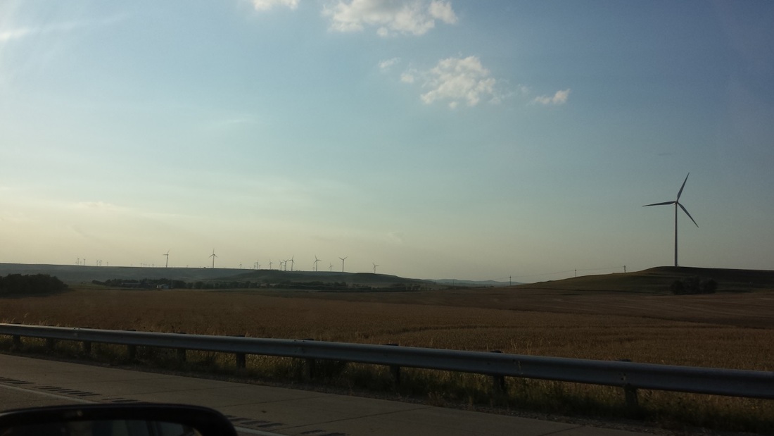
As we entered Kansas, the land started getting more barren. Here we saw a few oil rigs now and then, bearing witness to the oil boom in Kansas that didn’t materialize. We also saw massive windmill farms, but when we drove by most of the windmills were barely moving at all ;)
The terrain was quite different from our drive the previous days, which was quite hilly. The terrain around Illinois was quite flat, with corn fields stretching out to the horizon!
We made steady progress throughout the day, having breakfast and lunch in the car itself. Around lunch time we entered Missouri. The terrain started changing again here. The corn fields began disappearing and were being replaced by flat grasslands.
This was quite a sight to see! Most of the time we were on a long straight road stretching up to the horizon and on both sides were flat grasslands as far as the eye could see. This was literally a lonely planet spot – for quite a bit of the way we couldn’t see another car, house or animal in sight! I’ve never seen a sight like this before in my life, especially coming from India, where you can hardly go a few minutes without seeing another human being. It was a nice quiet and calm experience.
As we entered Kansas, the land started getting more barren. Here we saw a few oil rigs now and then, bearing witness to the oil boom in Kansas that didn’t materialize. We also saw massive windmill farms, but when we drove by most of the windmills were barely moving at all ;)
We reached Colby, KS around 8.30 that night. We had been really efficient on Day 3, having all meals in the car and hardly stopping on the way, in anticipation of all the sightseeing that was starting from Day 4! :)
Day 4 - Garden of Gods
Origin: Colby, KS
Destination: Estes Park, CO
Distance: 360 miles
States we drove through: CO
Destination: Estes Park, CO
Distance: 360 miles
States we drove through: CO
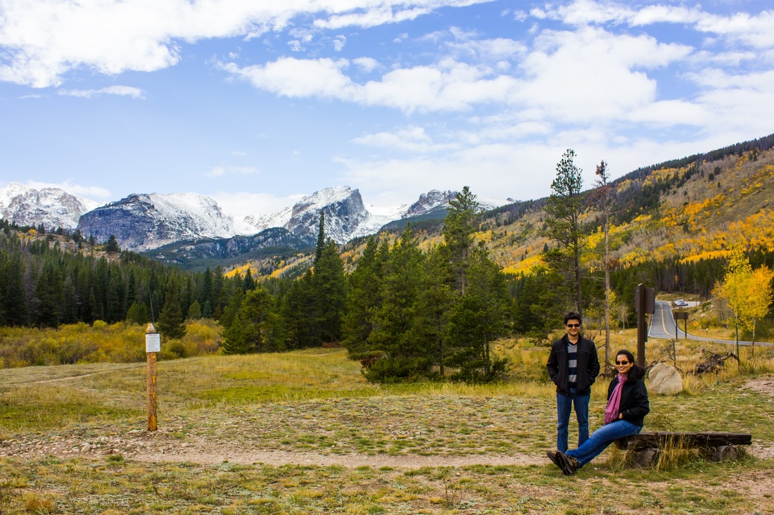
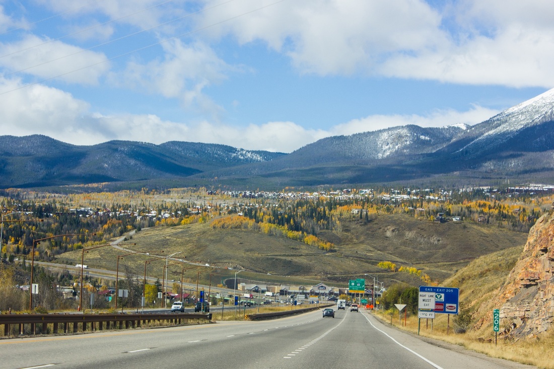
Abhishek and I were raring to go on Day 4. We both got our brand new hiking boots on (I’d spent almost a week picking mine out!), had a hearty breakfast and got going. We were both ready for a change in scenery after driving through the flat lands of the mid-west for the last couple of days. You can just make out the Rockies in the distance in the picture below. We were pretty excited, so we got out to take a picture :)
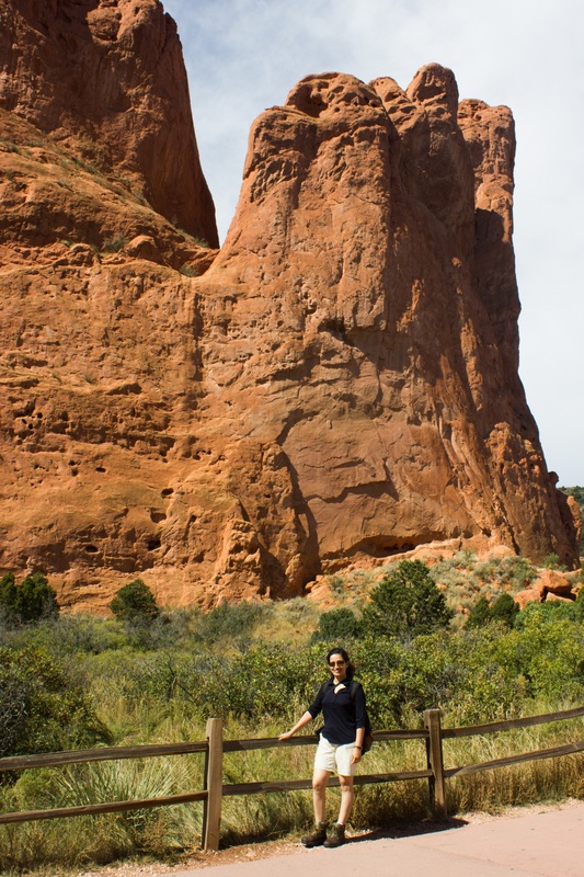
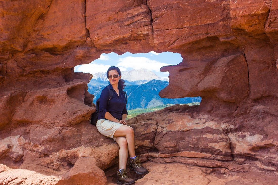
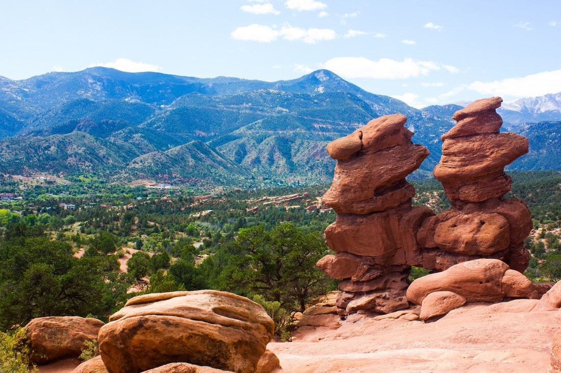
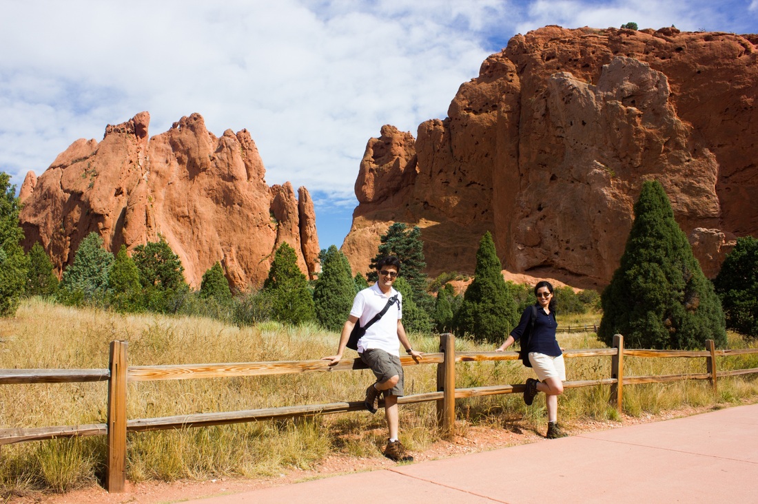
Our first destination for the day was Garden of the Gods. It’s a small park near Colorado Springs that has massive red rock formations between a large garden like area. Red rock is pretty rare in the area, and these formations were said to have occurred during a geographical upheaval. There was even a film running in the visitor center titled: “How did these rocks get here?” :)
Here are some pictures of the Garden of the Gods:
Here are some pictures of the Garden of the Gods:

We were done seeing the Garden of the Gods by about 1 in the afternoon. Our plan was to drive to the Royal Gorge Bridge from there and reach Rocky Mountain National Park later that night. However, at the Garden of Gods visitor center we got some disturbing news, - Rocky Mountain National park was scheduled to receive snow over the next two days, and parts of the park were going to be closed. This snow had timed our visit perfectly - we were only going to be in Rocky Mountains for 2 days! What to do?
So we decided to ditch Royal Gorge Bridge and drive to Rocky Mountain directly. There was no time to lose!
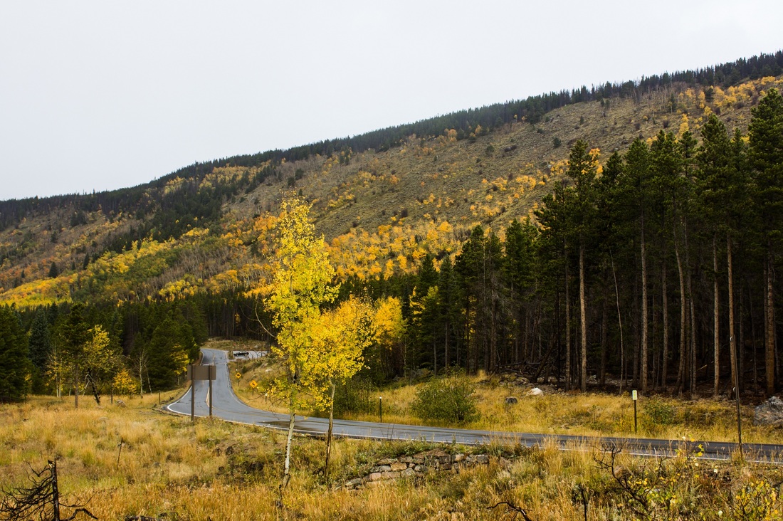
Some pictures of our drive from Garden of Gods to Rocky Mountains (a preview to the gorgeousness to follow!)
So we decided to ditch Royal Gorge Bridge and drive to Rocky Mountain directly. There was no time to lose!
Some pictures of our drive from Garden of Gods to Rocky Mountains (a preview to the gorgeousness to follow!)
This last picture reminded Abhishek of the English countryside :)
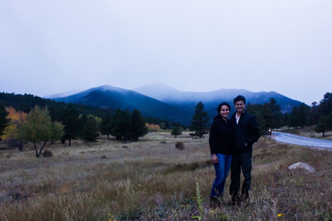
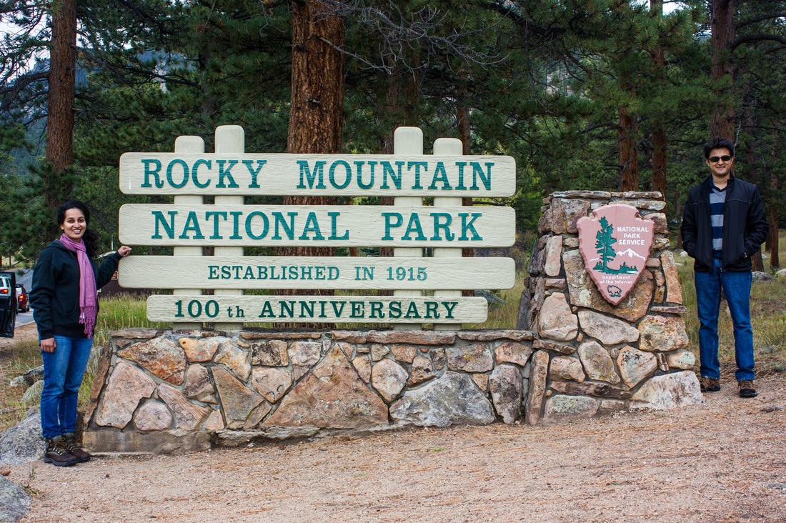
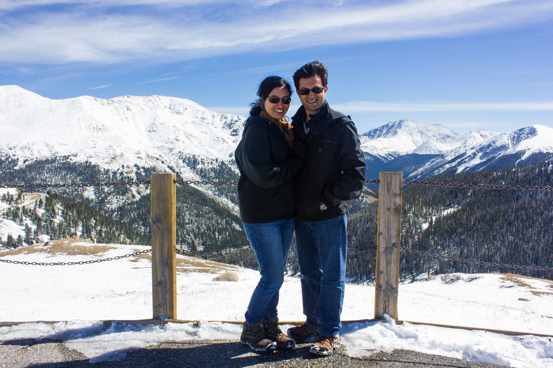
We got to the Estes park visitor center by 4-4.30pm after stopping for lunch on the way. When we got there, they told us to head to the park visitor center for the most updated information. The park visitor center was going to close by 5, so without stopping for a breath we rushed there. And there, they confirmed the bad news – parts of Trail Ridge Road, one of the prime attractions of the national park was going to be closed because of the unexpected snowfall. This road goes up to an elevation of almost 12,000 ft.
So we chinned up and decided to make the best of it. Another of park’s main attractions was Bear Lake, so we decided to head there and try our luck.
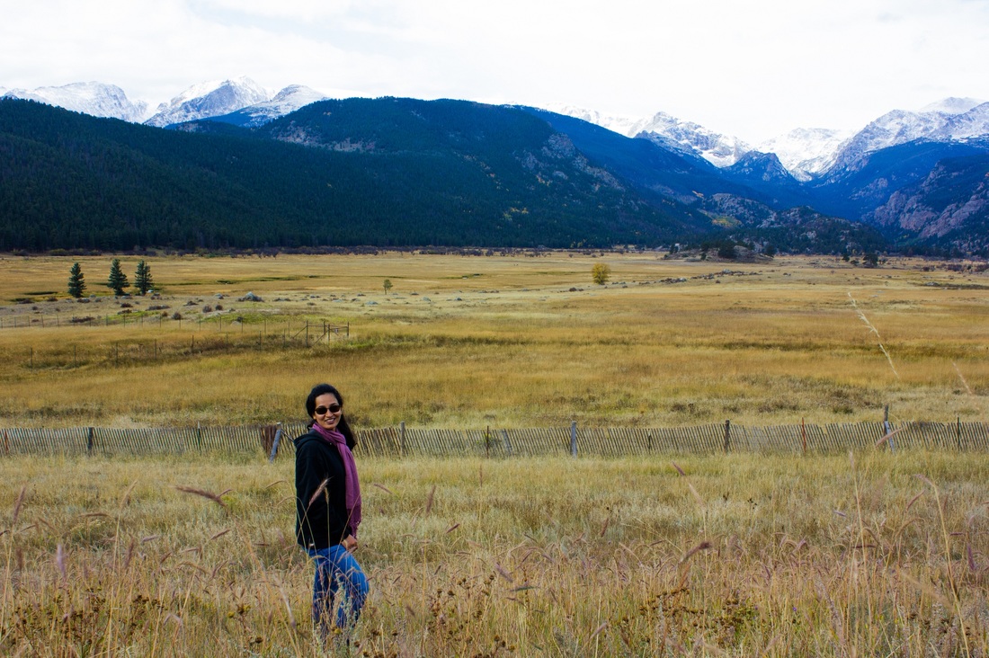
By this time it was almost 6 and had gotten pretty cold. My white shorts which looked great in the Garden of the Gods weren’t cut out for the mountains, so this is me in the evening with jeans, a cap and all the layers of hoodies I could find (I believe I’m wearing at least 2) ;)
We got to the Estes park visitor center by 4-4.30pm after stopping for lunch on the way. When we got there, they told us to head to the park visitor center for the most updated information. The park visitor center was going to close by 5, so without stopping for a breath we rushed there. And there, they confirmed the bad news – parts of Trail Ridge Road, one of the prime attractions of the national park was going to be closed because of the unexpected snowfall. This road goes up to an elevation of almost 12,000 ft.
So we chinned up and decided to make the best of it. Another of park’s main attractions was Bear Lake, so we decided to head there and try our luck.
By this time it was almost 6 and had gotten pretty cold. My white shorts which looked great in the Garden of the Gods weren’t cut out for the mountains, so this is me in the evening with jeans, a cap and all the layers of hoodies I could find (I believe I’m wearing at least 2) ;)
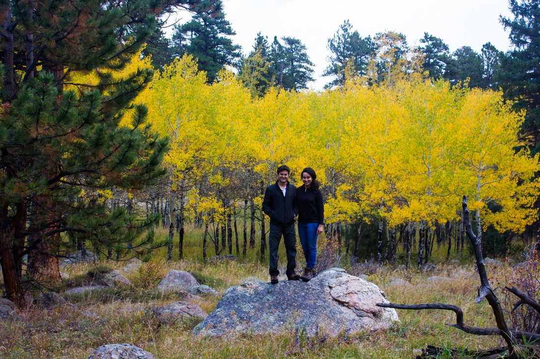
The fall colors in the Rockies were just breadth-taking. All the yellow comes from the aspen tree, which glows almost fluorescent among the stately dark green pines.
The drive to Bear Lake took around half an hour. Mid way it started raining with hail! We still tried to get out of the car at the lake, and even though it was only a few steps from the parking lot to the lake, we just couldn't do it. It was too cold and the hail was coming down to fast. There was just one more car in the whole lot (another mad hatter like us? ;)
So we gave up and turned back to head to our hotel in Estes Park. Just near the park entrance we saw a gigantic field where elk had come to eat (the hail had stopped by now).

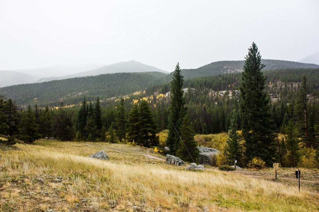
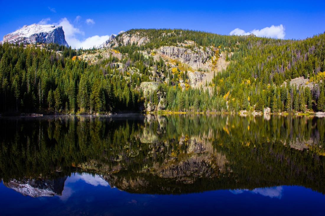
The Rockies were so very pretty! Perhaps it’s something about the mountains. They’re so old, grand and massive. There wasn’t one lookout point, or one curve in the road that was a must see (something which is pretty common in lots of other parks) – it was the whole scenery – the mountains, the stately pines, the glowing aspen. We had such a wonderful time here. More pictures to follow over the next few days. The Rockies are not a particularly tall range. The tallest peak (Long’s peak) is 14,259 ft (4,346 m). The foothills of the Himalayas are probably taller than this.
We were told of a famous Nepalese restaurant in Estes Park, so we went looking for it for dinner. After hunting for half an hour or so, we finally found it. It was a small hole in the wall. So this restaurant was owned by a Nepalese guy, and all around the restaurant he had pictures of Mt. Everest – facts about it, how to hike it etc., and not one picture of the Rockies, which was pretty funny :)
We were told of a famous Nepalese restaurant in Estes Park, so we went looking for it for dinner. After hunting for half an hour or so, we finally found it. It was a small hole in the wall. So this restaurant was owned by a Nepalese guy, and all around the restaurant he had pictures of Mt. Everest – facts about it, how to hike it etc., and not one picture of the Rockies, which was pretty funny :)
Day 5 - Rocky Mountain National Park
Origin: Estes Park, CO
Destination: Winter Park, CO
Distance Driven: 80 miles
Destination: Winter Park, CO
Distance Driven: 80 miles
Abhishek woke me up at 6.30am the next morning with a gigantic smile on his face. He was saying, “The sky is bright blue and perfectly clear! Let’s head out to Bear Lake.” The prediction for the next two days was that it would snow/rain the whole day. So we were pretty excited to have some nice weather.
We rushed through breakfast and hotel checkout, and got on our way.
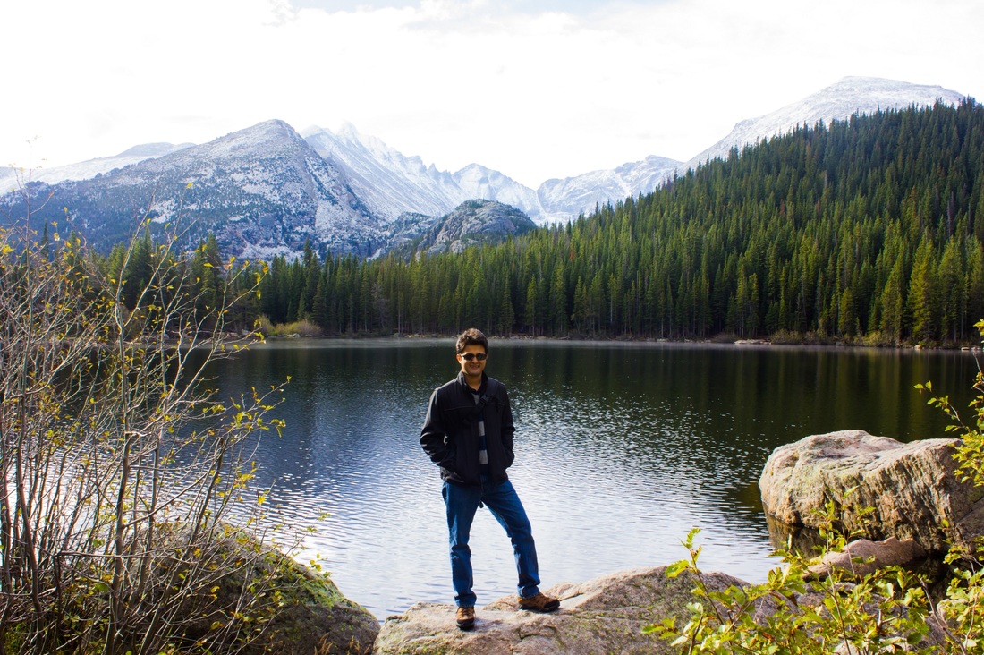
We were the first ones to arrive at Bear Lake, and it was such a gorgeous sight. It seemed like a slice of heaven!
Bear Lake is a small lake nestled between the mountains. When we got there, the water was completely clear and still, not a leaf was moving, and not a soul could be heard. The picture below looks so pretty, but being there was something else. I remember telling Abhishek that in the next 2 days if this is all I get to see in the Rockies, the trip is already worth it!
We rushed through breakfast and hotel checkout, and got on our way.
We were the first ones to arrive at Bear Lake, and it was such a gorgeous sight. It seemed like a slice of heaven!
Bear Lake is a small lake nestled between the mountains. When we got there, the water was completely clear and still, not a leaf was moving, and not a soul could be heard. The picture below looks so pretty, but being there was something else. I remember telling Abhishek that in the next 2 days if this is all I get to see in the Rockies, the trip is already worth it!
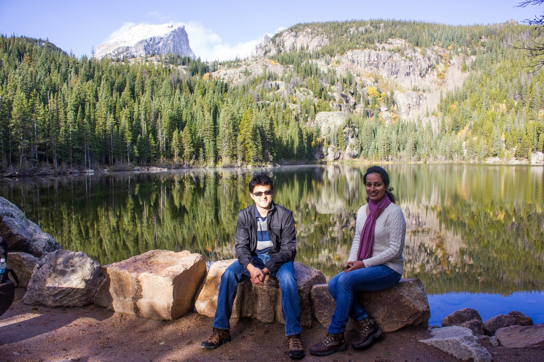
There is really nice half mile loop around the lake that we did. We sat in quite a few places just to admire the scenery around us. Abhishek and I were talking about how when you visit tourist spots in cities, like the Statue of Liberty in NY for example, you’re impressed and appreciative, but you’re never really blown away the way you are when you see something beautiful in nature. We had a similar experience when we visited the 12 Apostles in Australia.
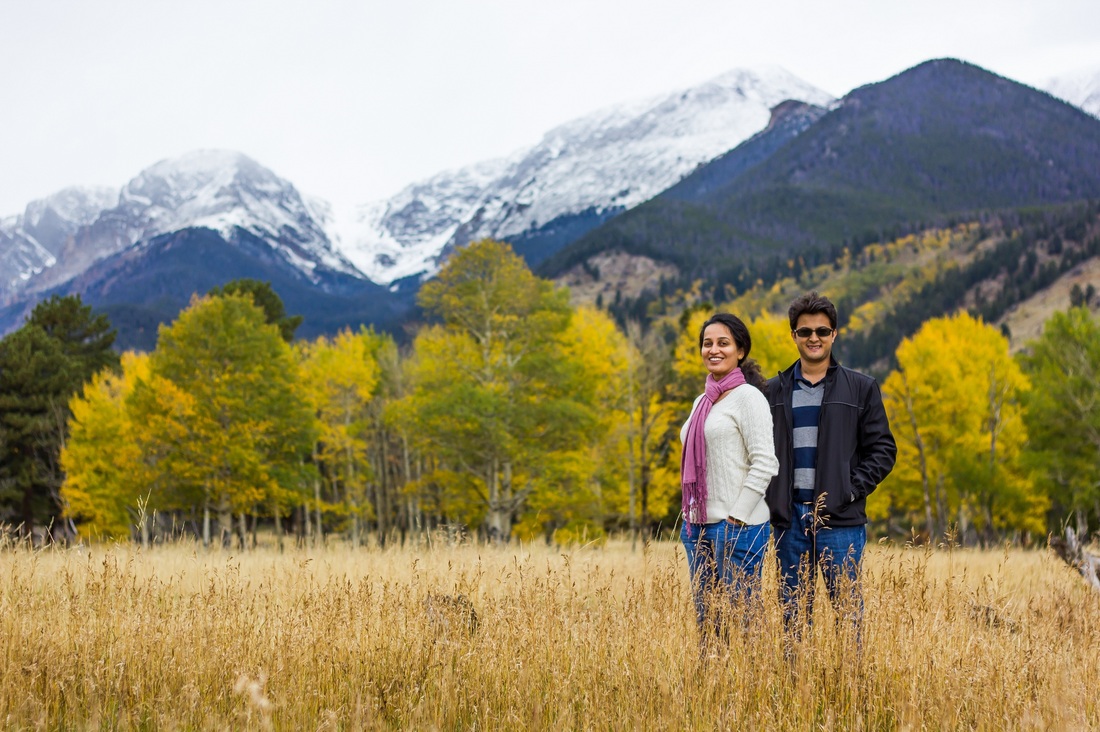
With our hearts full with our wonderful experience at Bear Lake we head out to see the rest of the park, all the while thanking the weather gods for a wonderful day. Rocky mountain national park is such a pretty park – at every turn we wanted to get down and take a picture. I think the park had an especially strong effect on Abhishek, he just kept saying, Oh Wow Paddie! Look at this sight! Are you looking or not? It is soo pretty. At the end of the day Abhishek even declared, this is where I would like to retire!
With our hearts full with our wonderful experience at Bear Lake we head out to see the rest of the park, all the while thanking the weather gods for a wonderful day. Rocky mountain national park is such a pretty park – at every turn we wanted to get down and take a picture. I think the park had an especially strong effect on Abhishek, he just kept saying, Oh Wow Paddie! Look at this sight! Are you looking or not? It is soo pretty. At the end of the day Abhishek even declared, this is where I would like to retire!
We did some souvenir shopping later in the afternoon. The park had a really nice shop that we spent some time finding, and then spent time shopping :) We left for Winter Park, CO by around 5pm that evening.
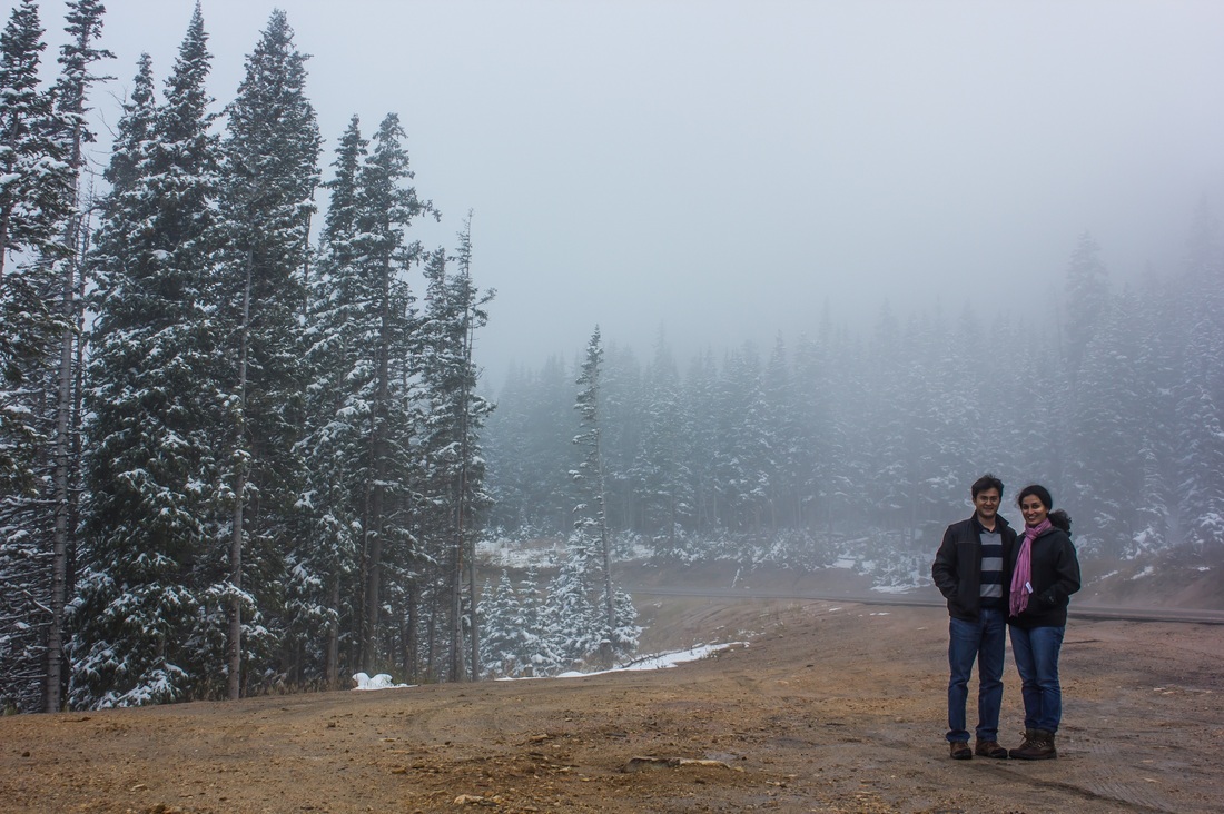
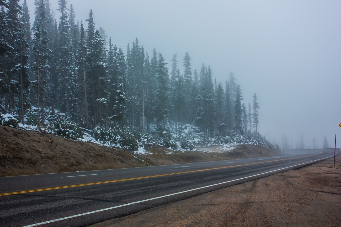
Winter Park was at a much higher altitude that Estes Park (which is in a valley), so we were steadily climbing. Soon our luck ran out and it started snowing. We got out of the car for one hurried picture.
By the time we got to the hotel, we were both quite tired and hungry. There didn't seem to be a restaurant close by, and we were quite apprehensive about getting back into the car for driving, so we just made a sandwich each and hit the sack.
Day 6 - Independence Pass, Maroon Bells Lake
Origin: Winter Park, CO
Destination: Grand Junction, CO
Distance driven: 270 miles
Destination: Grand Junction, CO
Distance driven: 270 miles
| We got up to this sight: | 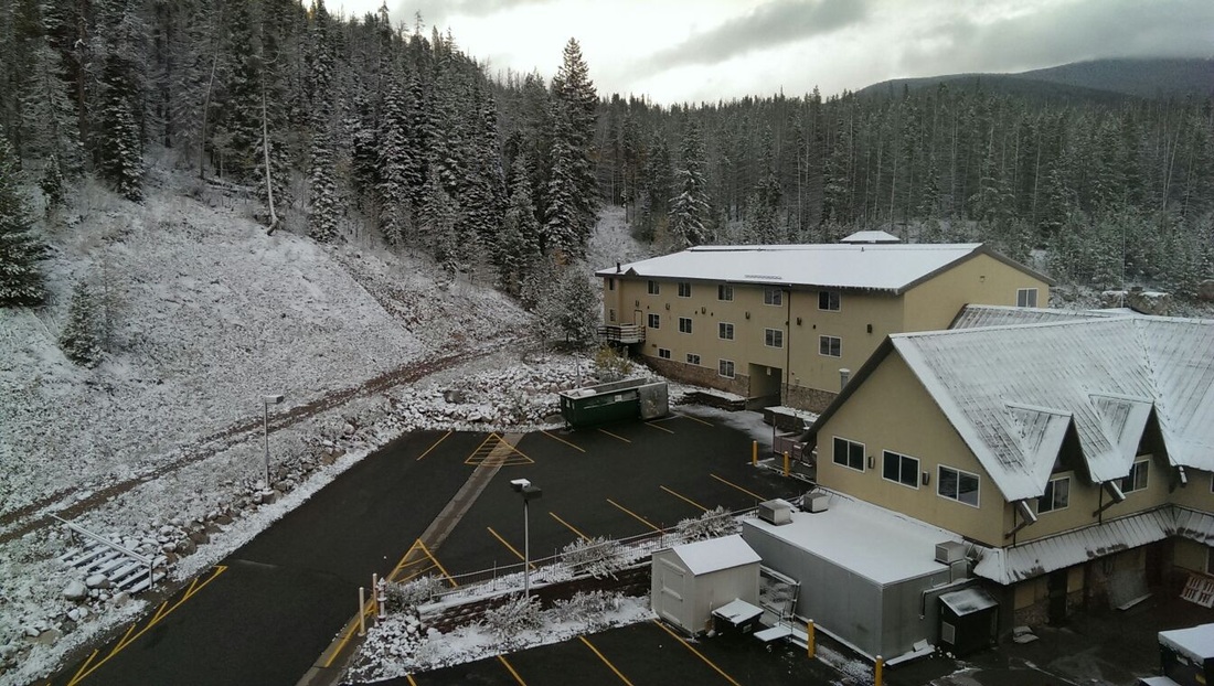 |
We were so excited that we were leaving the snow behind in Boston, that I had happily given away all my snow things, the snow shovel, the de-icing fluid, including the small handy ice scraper that had sat in my car the whole of the summer in Boston. We were just about prepared for the cold, but definitely not for the snow. When we went down to the reception to ask for some snow scraping equipment, we found not only were they not prepared, there were a bunch of other hotel guests who were just as unprepared as us. At least we weren’t the only ones :)
After someone hunted around in the back and found some snow scrapers, we scraped off the snow and head off. It wasn’t even snowing in Boston yet! I suppose it served me right for making all those jokes about how I’m escaping the winter back in Boston.
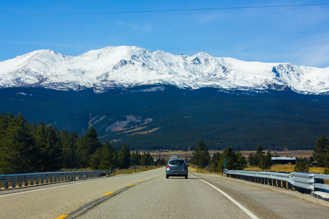
We were continuing at almost the same elevation and driving to Independence pass. The car was straining a bit, and didn’t seem to have much power. We learnt that for every 1000 ft of elevation rise, there is a loss of 3-4% of horsepower. With the little Corolla having 180hp and driving at 10,000 ft, she only had 100hp to drive through snow and carry the two of us and a trunk full of luggage.
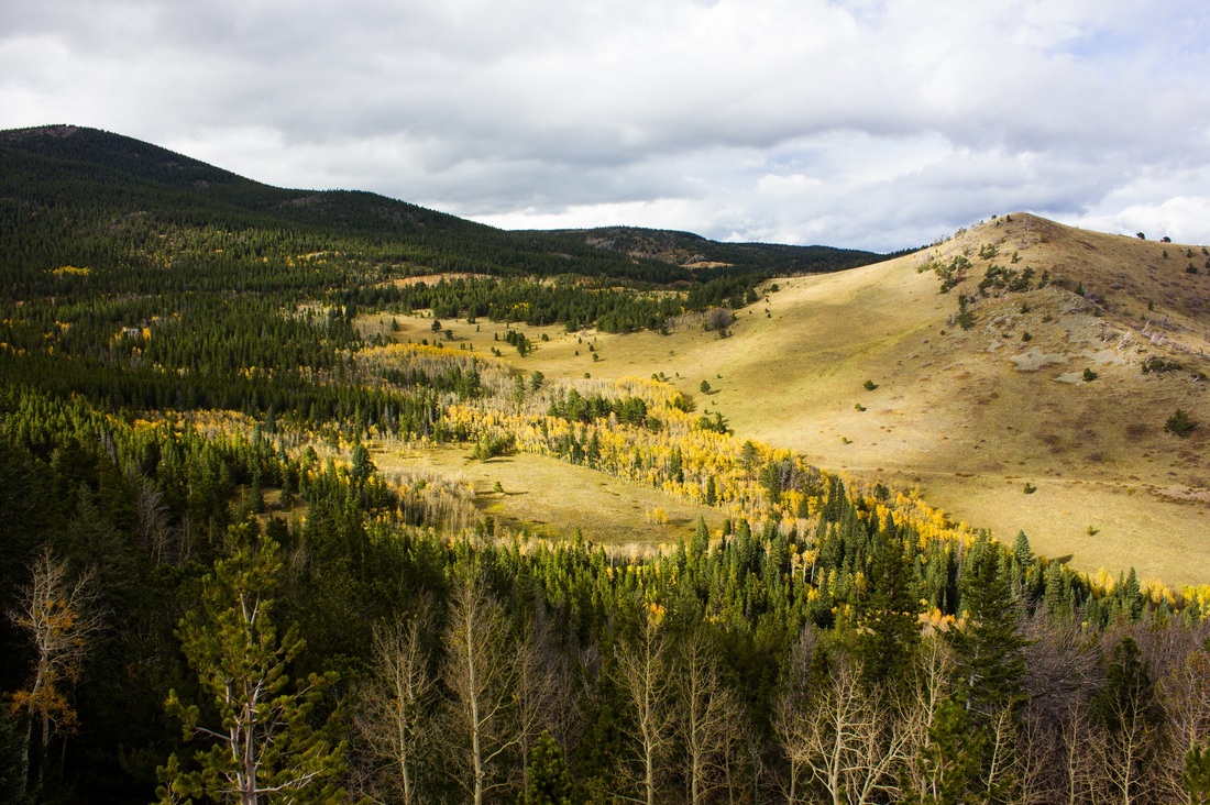
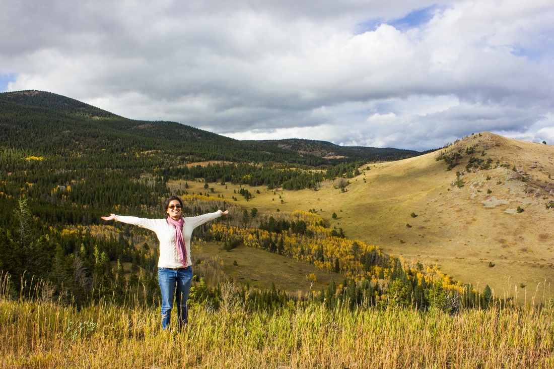
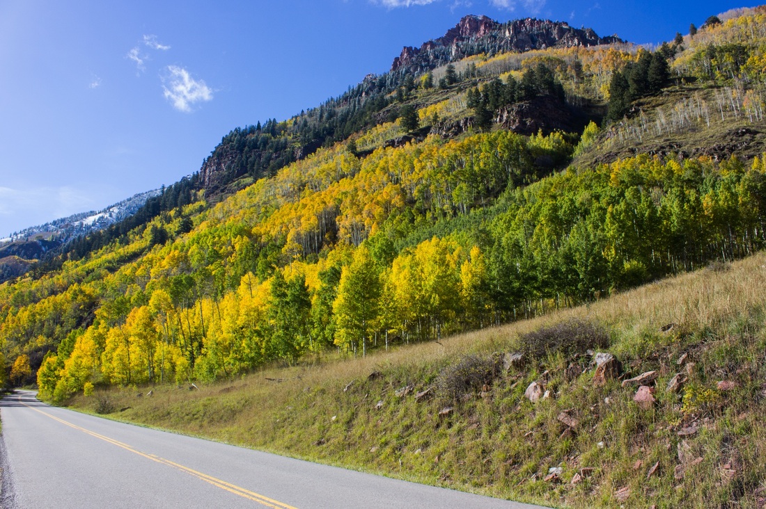
The drive was quite pretty and we drove by many towns nestled among the hills. Abhishek has decided that we will be retiring in one of these towns :) He is going to ski in the winter, and go hiking in the summer. He also advised me to work on staying fit so that I will be able to keep up with him in our old age.
After someone hunted around in the back and found some snow scrapers, we scraped off the snow and head off. It wasn’t even snowing in Boston yet! I suppose it served me right for making all those jokes about how I’m escaping the winter back in Boston.
We were continuing at almost the same elevation and driving to Independence pass. The car was straining a bit, and didn’t seem to have much power. We learnt that for every 1000 ft of elevation rise, there is a loss of 3-4% of horsepower. With the little Corolla having 180hp and driving at 10,000 ft, she only had 100hp to drive through snow and carry the two of us and a trunk full of luggage.
The drive was quite pretty and we drove by many towns nestled among the hills. Abhishek has decided that we will be retiring in one of these towns :) He is going to ski in the winter, and go hiking in the summer. He also advised me to work on staying fit so that I will be able to keep up with him in our old age.


We drove through Leadville, the highest incorporated city in the US.
We saw some truly picturesque spots on the way. We both were really thankful we got the time to do this road trip, because for sure, we would not have seen so many sights as well as had such a holistic experience at each place if we had just flown in and flown out.
So onwards to Independence pass! Independence pass is a high mountain pass in the Rocky Mountains at an elevation of 12,000 ft. It is on the Continental Divide, named so since on either side of the divide rivers drain into the Pacific Ocean on one side and the Atlantic Ocean on the other.
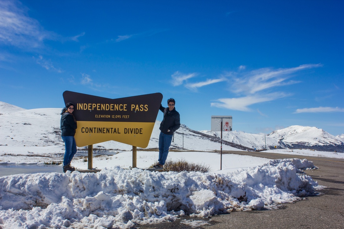
We had anticipated taking these pictures in shorts, but well..too many bad weather jokes in Boston :)
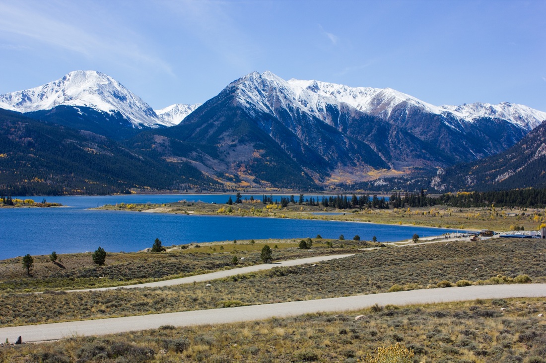
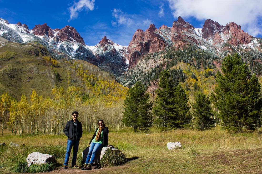
From Independence pass, we drove to Maroon Bells Lake in Aspen, CO. This is one of the most photographed spots in the US.
From Independence pass, we drove to Maroon Bells Lake in Aspen, CO. This is one of the most photographed spots in the US.
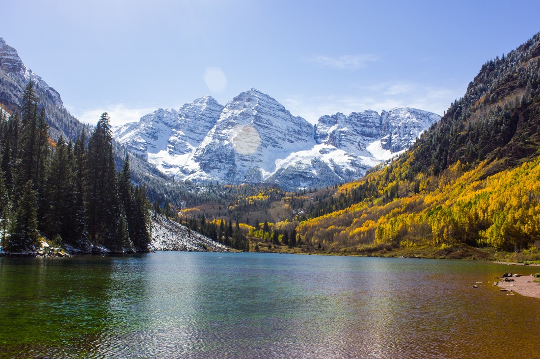
Truly a very pretty spot – mountains with snow, mountains with fall colors, a green blue lake – what else could one ask for? Perhaps fewer people? ;) There were quite a few people here, all enjoying the nice weather and scenery. It was quite remarkable to us that just 3-4 hours back we were ankle deep in snow, and here there were people in shorts!
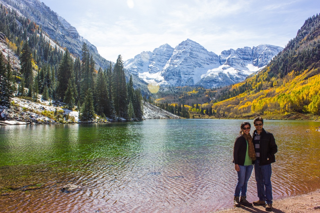
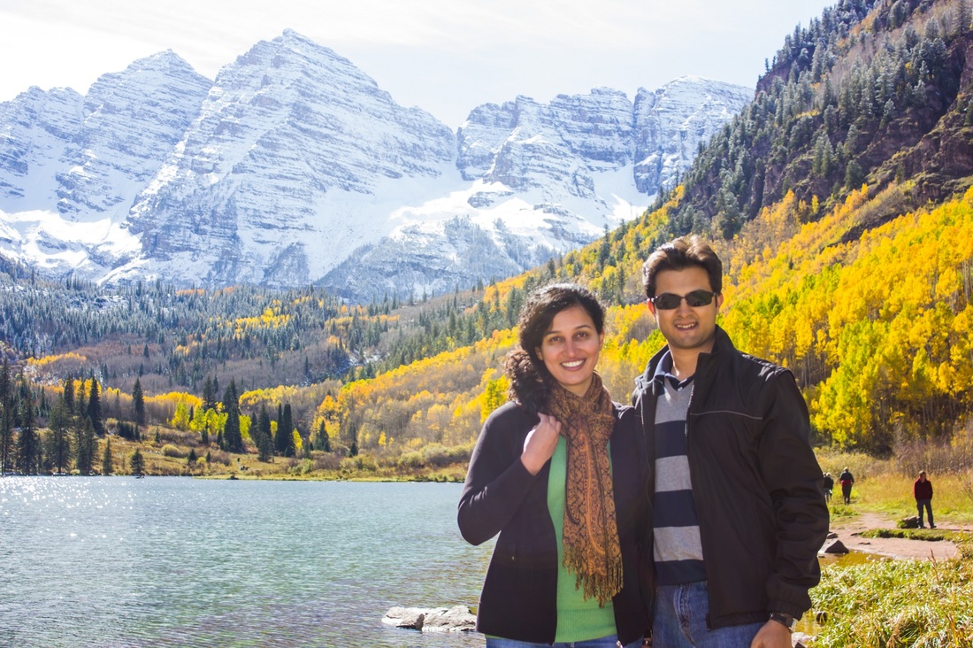
We had a snack here by the lake, and then headed on towards Grand Junction. We reached Grand Junction around 6 in the evening and the light was just beginning to fade. We decided to try our luck to see if we could drive by Colorado National Monument to see the place, and we were glad we did.
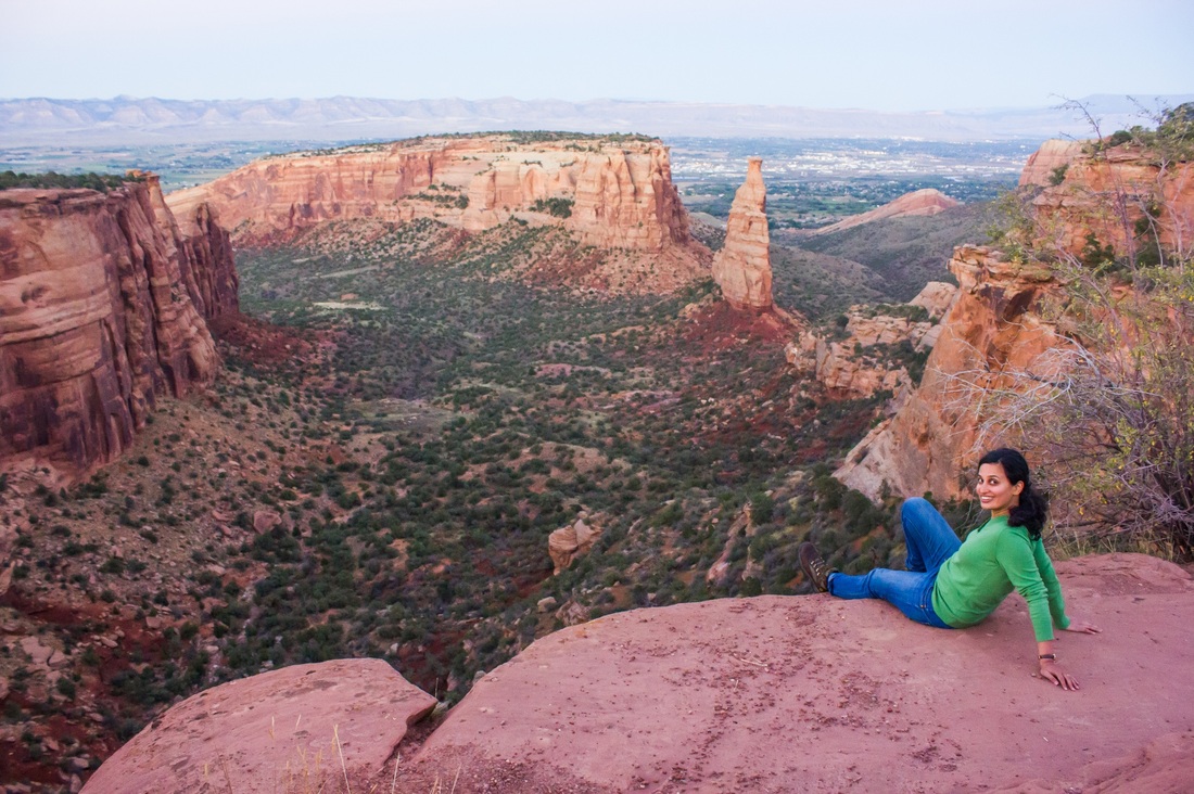
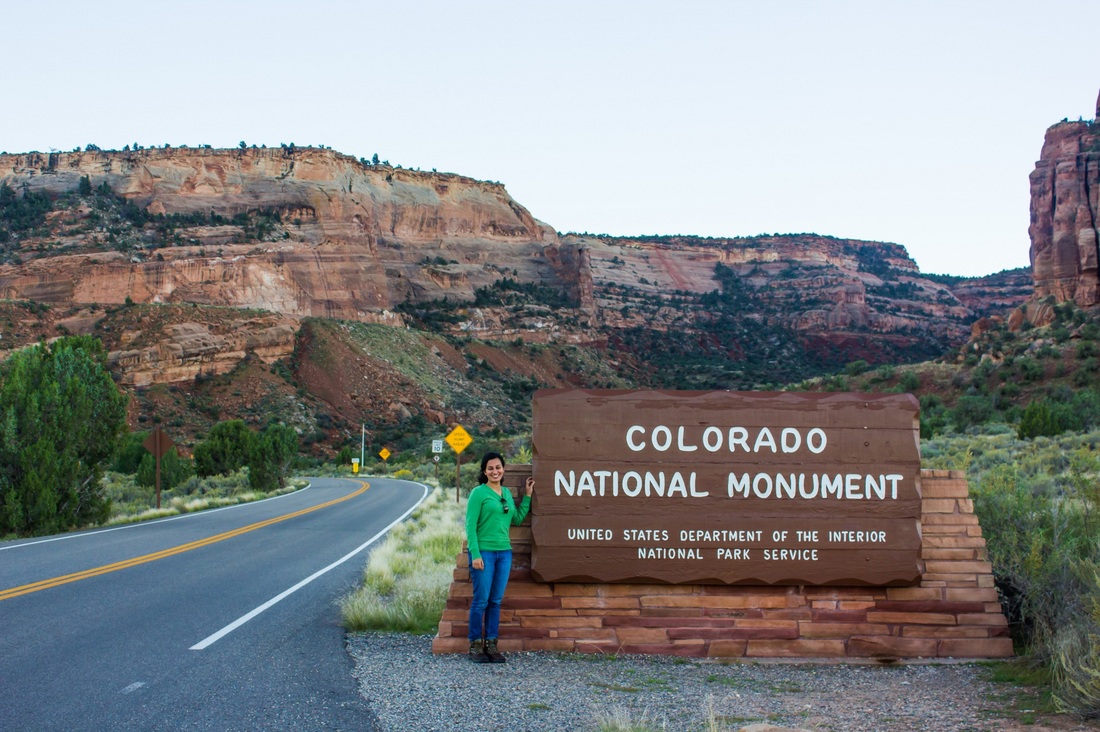

Notice how at each spot one layer of clothing has come off – from two hoodies at Independence pass, to one thin jacket at Maroon bells, and just a thin sweater at Colorado National Monument – all in a day’s work! The vegetation around us also changed with the weather – from the stately pines of the Rockies we were now in hardy desert shrub country.
For dinner Abhishek asked me to find a place, and by some mistake (on my part) we landed up driving 15 miles to eat some very average Chinese food. After a healthy bit of squabbling it was time to hit the sack.
For dinner Abhishek asked me to find a place, and by some mistake (on my part) we landed up driving 15 miles to eat some very average Chinese food. After a healthy bit of squabbling it was time to hit the sack.
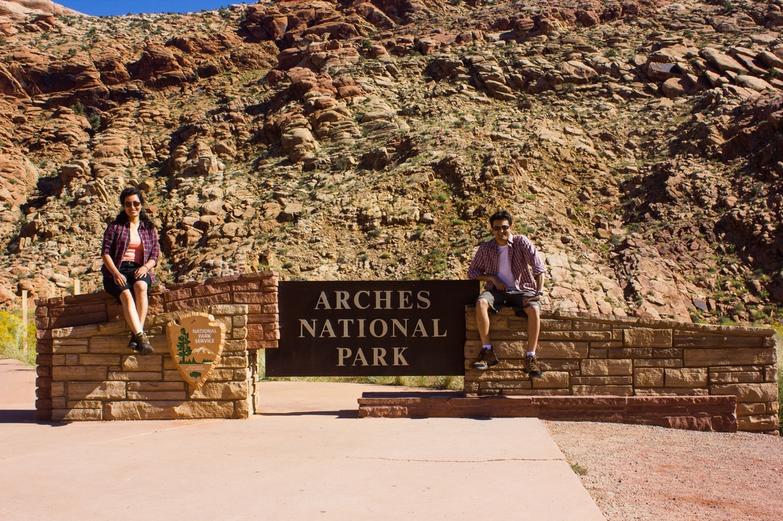
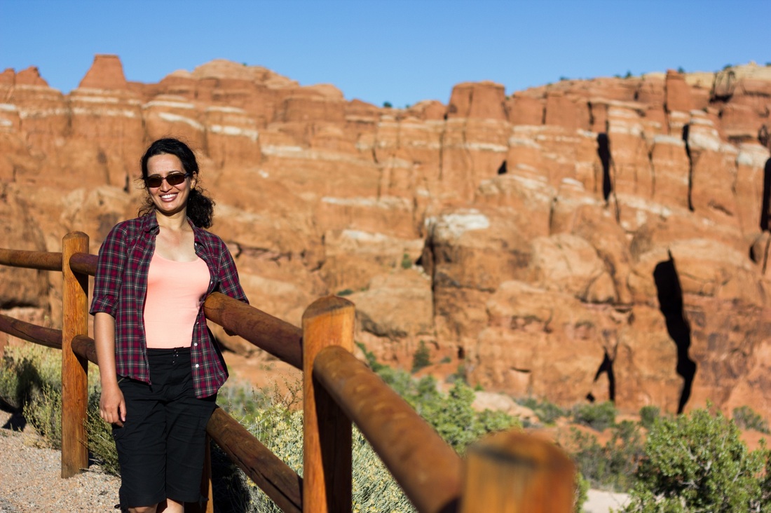
Day 7 - Arches National Park
Origin: Grand Junction, CO
Destination: Blanding, UT
Driving distance: 160 miles
Destination: Blanding, UT
Driving distance: 160 miles
We had a 1.5 hour drive to Arches National park from Grand Junction in the morning. We drove through a very scenic route, and as we were now in desert climate, finally the shorts could make a comeback.
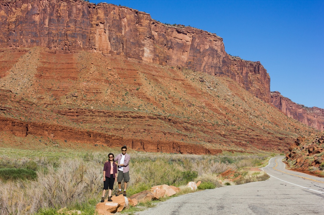
This area has quite a unique history. Almost 300 million years ago a sea flowed into the region. Over time the water evaporated leaving behind large salt flats. Debris and sand from nearby places including the Rockies slowly deposited over these salt areas. As more and more debris deposited, pressure from the upper layers hardened the lower sand layers into rocks - this rock is called Navajo sandstone. The formation of rocks put enormous pressure on the salt below, liquefying it. Portions of the salt flats then collapsed underneath the sandstone layer, causing upward thrusts in in some places and depressions in others. These upward thrusts resulted in big blocks of red sand stone rising above the surface, making massive formations, as can be seen in the pictures above.
Wind and water are slowly eating away into these blocks, breaking away pieces of rock and eroding the surface of these formations. Over time these impressive formations will just be a mountain of dirt! So like the glaciers, enjoy these while the last!
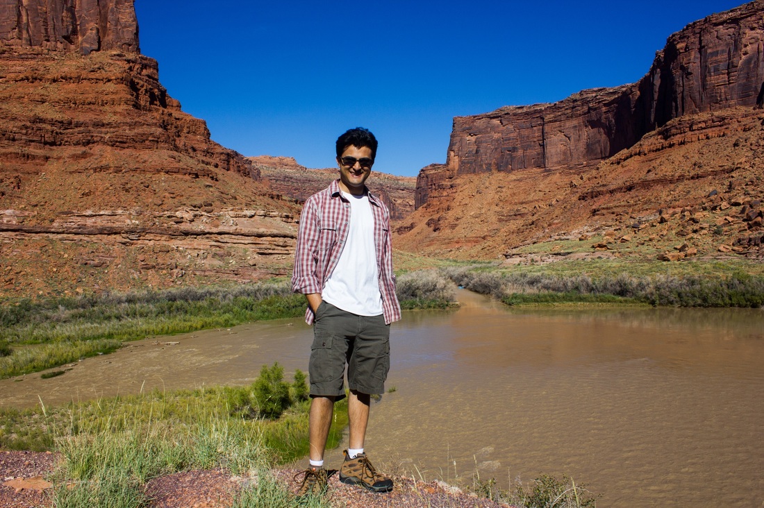
We arrived at Arches National Park around lunch time, and boy was it bright and sunny, and hot!
Wind and water are slowly eating away into these blocks, breaking away pieces of rock and eroding the surface of these formations. Over time these impressive formations will just be a mountain of dirt! So like the glaciers, enjoy these while the last!
We arrived at Arches National Park around lunch time, and boy was it bright and sunny, and hot!
We then set off to see the world famous Delicate Arch! The hike to Delicate Arch was a tiring hike - it was around a 3 mile hike roundtrip, with a climb almost the whole way and hardly any shade.

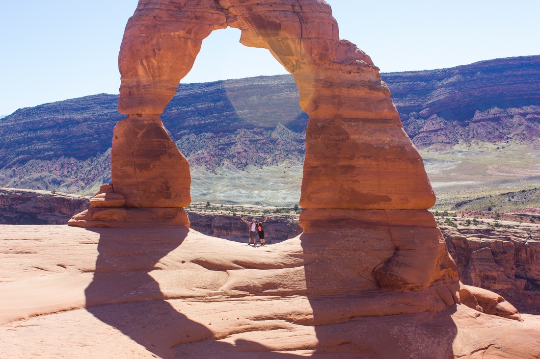
The sight at the end of the hike definitely made it worth it!
Arches at the park are again the result of the persistent power of wind and water. Water seeps into the soft and porous sandstone during rains. In winter the water freezes into ice, which chips away the rock as it expands. Over time chunks of rock fall out, and wind smooths out the edges. Many of these sandstone blocks completely collapse as pieces of rock fall out, while the few which have the right combination of stable rock form these impressive fins.
The park calls any rock with more than a meter long gap as an arch. There is no requirement on the width of the gap. With this metric there are over 2000 arches at the park!
Delicate arch was so pretty, it is right at the edge of the mountain, and has the La Sal Mountains as the backdrop. It is hard to believe it is not man made, it was so very perfect!

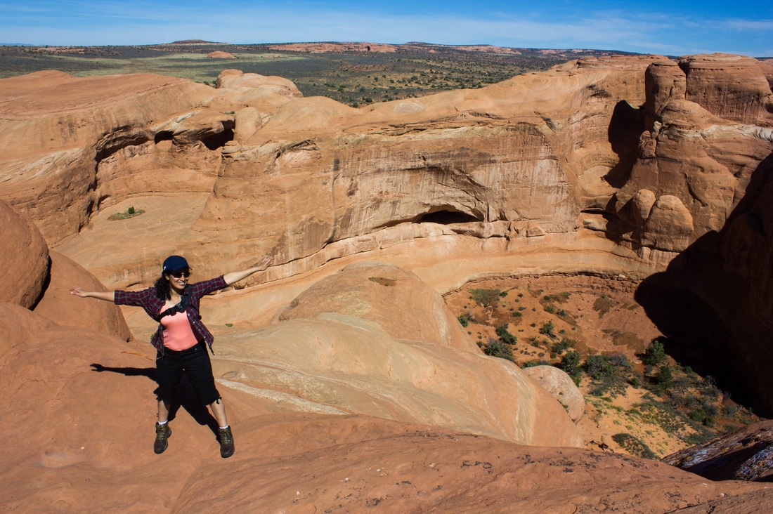
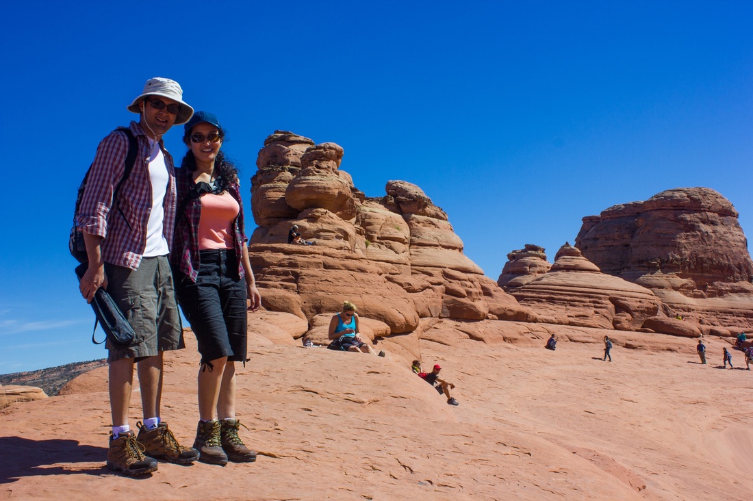
We had a small snack near Delicate Arch, and were there for half an hour or so, admiring it’s beauty. We then hiked back down, which was really fun, and proceeded to see the other arches in the park.
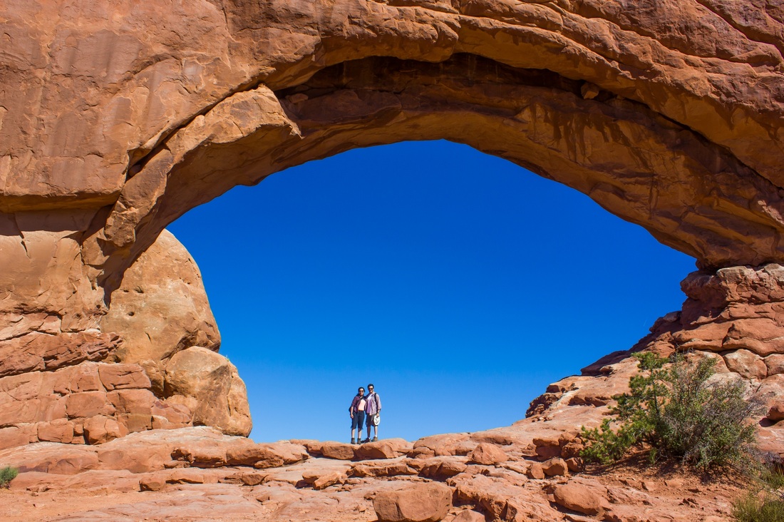
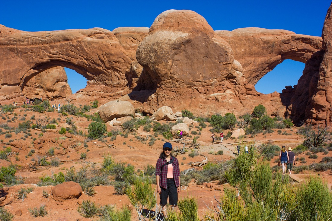
The pictures below are of a set of arches called the windows arches:
The pictures below are of a set of arches called the windows arches:
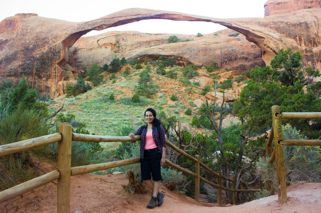
The fiery furnace, and the almost collapsing Landscape Arch (more delicate than the delicate arch?)
With our hearts full, lots of Vitamin D and a deep tan, we left the park around 7 in the evening and headed to Moab for dinner. We had a great dinner at an Italian restaurant, and started driving towards our destination for the night – Blanding, UT. Even though Blanding was only an hour and a half away from Moab, this was the toughest drive of the trip. We were both extremely tired and sleepy, and the road was quite narrow and deserted. I was trying really hard to stay awake as the co-driver, but dozed off in the last 20 minutes. Abhishek drove slowly and carefully to get us to Blanding – great driving on his part!
Day 8 - Monument Valley
Origin: Blanding, UT
Destination: Kanab, UT
Driving distance: 290 miles
Destination: Kanab, UT
Driving distance: 290 miles
 | After a good night’s sleep and a filling breakfast we left the sleepy, small town of Blanding towards Monument Valley. The drive there was really gorgeous, large monoliths protruding out of the deep red, arid and thirsty desert. |

The structure above is called the Mexican Hat.
The gorgeous monument valley - a sight for sore eyes!
The gorgeous monument valley - a sight for sore eyes!
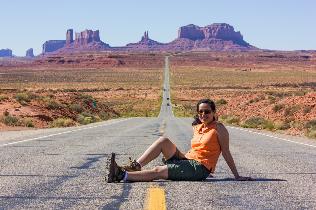
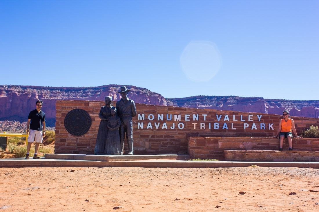

We spent about an hour or so at the Monument Valley tribal park, admiring the huge monoliths. These massive monoliths are slowly but surely giving in to the sustained power of wind and water, which will in a few decades reduce them to a massive pile of dirt – the earth eventually levels everything!
There were quite a few tourists, including some tour buses. We shopped around for some nice souvenirs, and just as we were entering the only restaurant in a 100 mile radius, they closed for the day! We were back to a lunch of bread and a spread, and continued on towards the Horseshoe bend, a horse shoe shaped meander of the Colorado river in Page, AZ.
On the way we found a nice little Mexican restaurant and had a late lunch. As we continued our drive, we saw no towns or gas stations on the way, and were anxiously checking the gas level! We were relived to find a gas station at Page when we were almost at 10% gas!
We reached the Horse shoe bend around 4 in the afternoon. It was packed with tourists. Here’s our only picture:
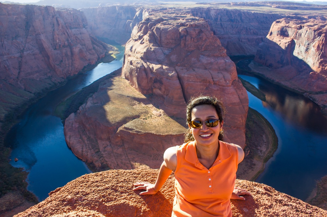
The fact that the whole bend couldn’t fit in the frame won the argument for Abhishek to get a 2k wide angle lens :) We’ll go back there once the new lens arrives!
We walked a bit around the Glen Canyon dam, which is a few miles from the Horseshoe bend, before driving onto our destination for the night – Kanab, UT.
We walked a bit around the Glen Canyon dam, which is a few miles from the Horseshoe bend, before driving onto our destination for the night – Kanab, UT.
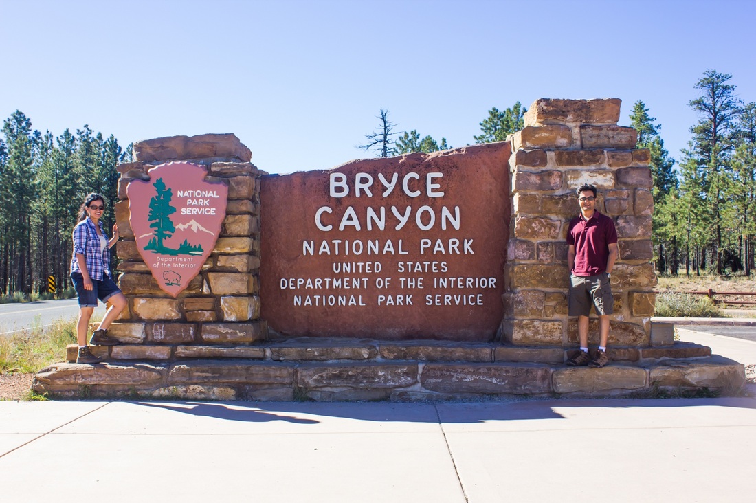
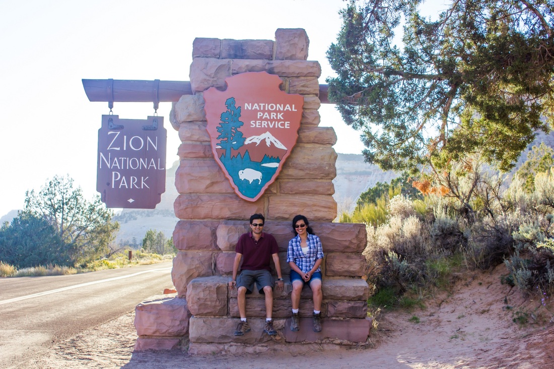
Day 9 - Bryce Canyon National Park
Origin: Kanab, UT
Destination: Rockville, UT
Driving distance: 160 miles
Destination: Rockville, UT
Driving distance: 160 miles
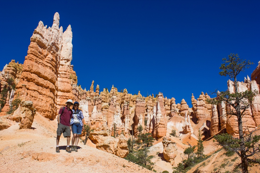
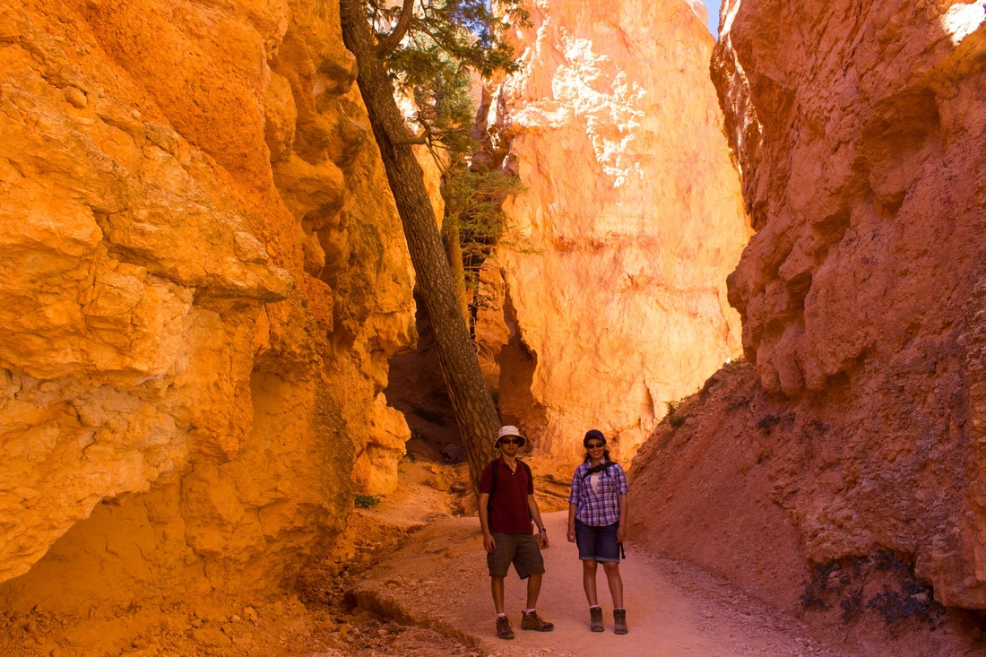
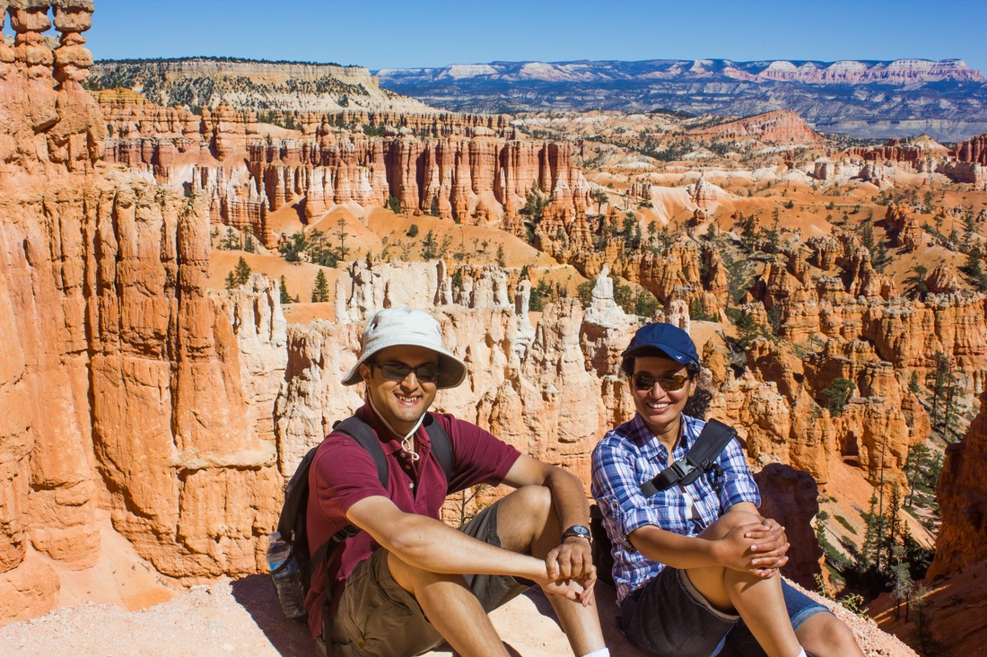
Day 9 we headed to Bryce Canyon National Park. The canyon is formed of much softer sandstone than monument valley. It has distinctively shaped narrow and sharp structures called hoodoos, which almost look like stalagmites made of sand. There are thousands of orange and white colored hoodoos in the canyon, with a sprinkling of green vegetation poking out in between, and the effect was quite breath taking - we had never seen anything like it before.
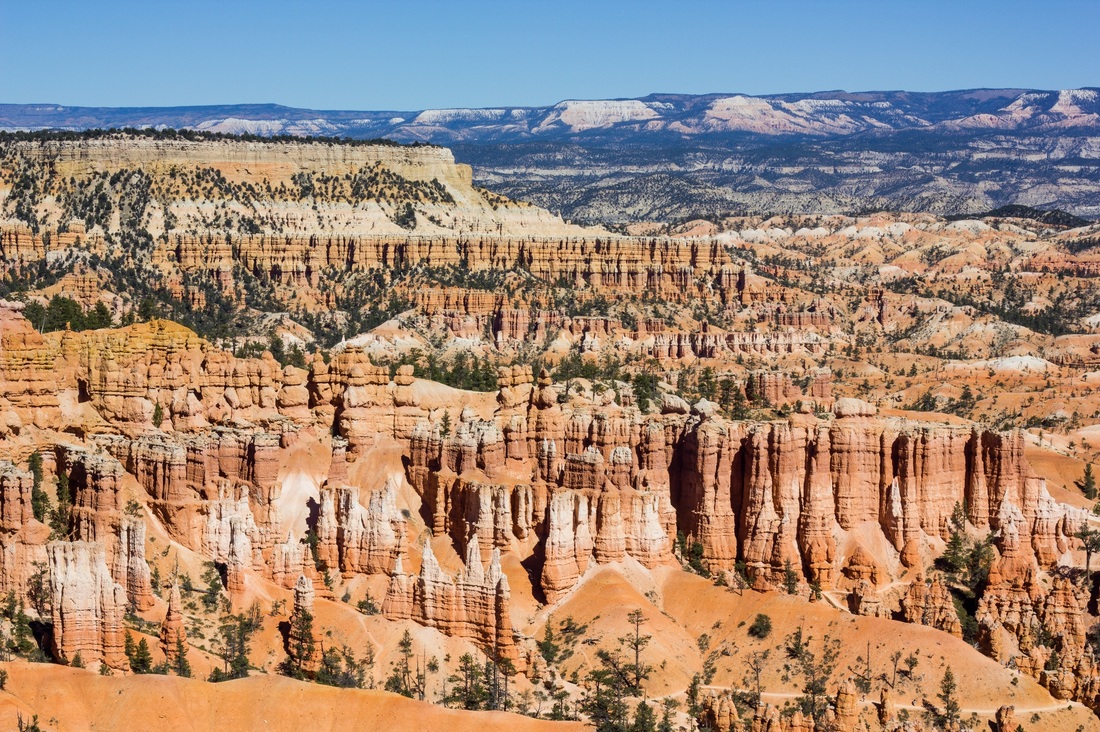
We did a nice 5 mile hike through the canyon and walked among the hoodoos.
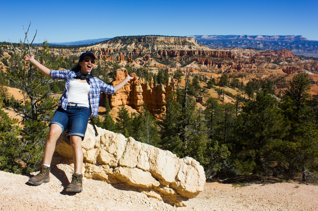

By this time in the trip, we had a deeeeep tan!
We were done touring Bryce by 4 in the afternoon. We then had an amazing lunch at Ruby’s inn. Ruby was a guy who had set up a small inn at 1916, before Bryce was a National Monument or Park. He and his wife had just happened to stop at the canyon and loved the place. There were hardly any families there, but still they decided to settle there and farm. Over time they invited friends to visit, and slowly as they had more and more folks visiting, they set up an inn. That same inn now is a major establishment and is still family owned. It was a very picturesque place with photos of the canyon and surroundings from the last 100 years. We bought some lovely souvenirs there.
After lunch it was time to move on to our next adventure – onwards we went to Bryce’s more famous neighbor – Zion!
The drive from Bryce to Zion was about 4 hours. We were to stay in Zion for 2 nights. We arrived around 8 in the evening. We parked our bags, had a great Thai dinner and retired for the night.
Day 10 - Zion National Park
Origin: Rockville, UT
Destination: Rockville, UT
Driving distance: 0 miles
Destination: Rockville, UT
Driving distance: 0 miles
 | Look at that tan! |
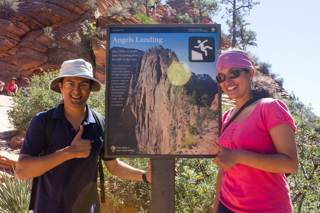
Day 10 was a day that we were very excited about as well as very anxious about! Day 10 we were going to do the Angels Landing Hike at Zion National Park. It is one of the most popular hikes in the National Park system, while also being one of the toughest.
We a good breakfast, caught the Zion shuttle and were at the base by 8am or so. The hike to Angel's Landing is around 5 miles and is a steady climb.
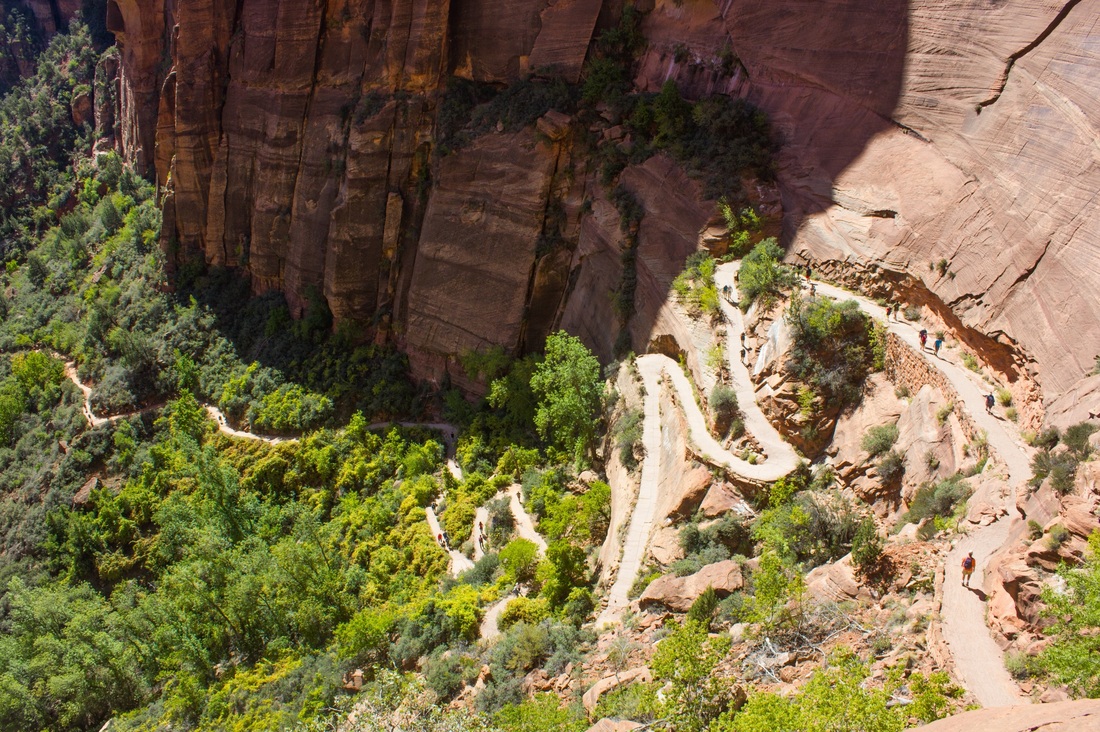
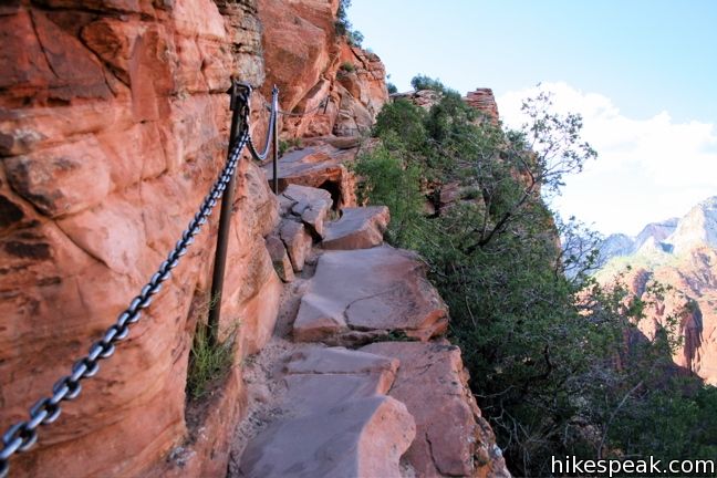
We reached the base of the summit, and this was the sight that greeted us! We had to climb up this narrow path to reach the summit. There were multiple warnings along the way about the difficulty of this hike. There was even one warning saying there have been 6 deaths on this stretch of the hike :O
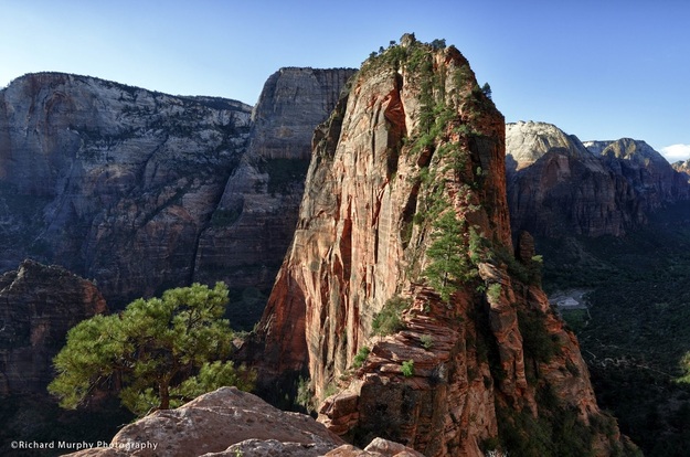
The trail up. Hold on for your life!

| Enroute! | 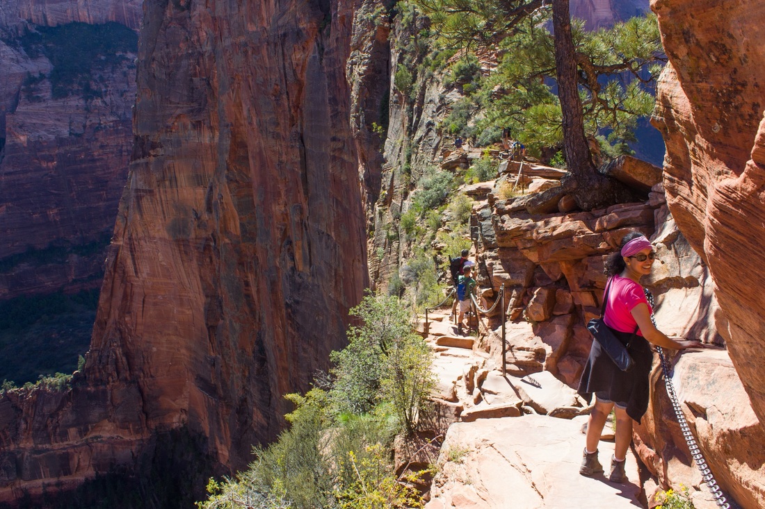 |
Abhishek and I were extremely careful on the hike, going slowly and holding onto the chains at all times. We saw a dad with his 8-10 year old daughter on the hike. The daughter and dad were chained together at the waist! We thought that was so adventurous and cool of them!
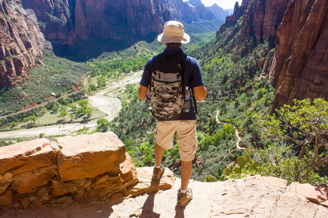
At the end, the view at the top made it all so very worthwhile!!
At the end, the view at the top made it all so very worthwhile!!
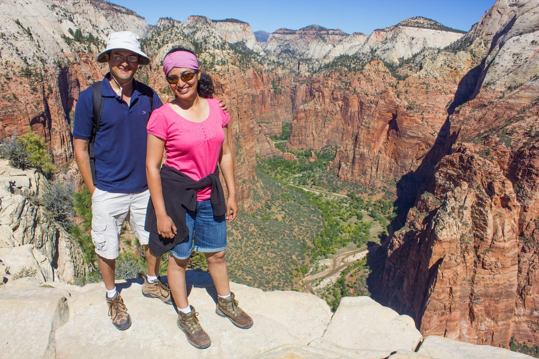
The gorgeous Zion valley spread out beneath us!
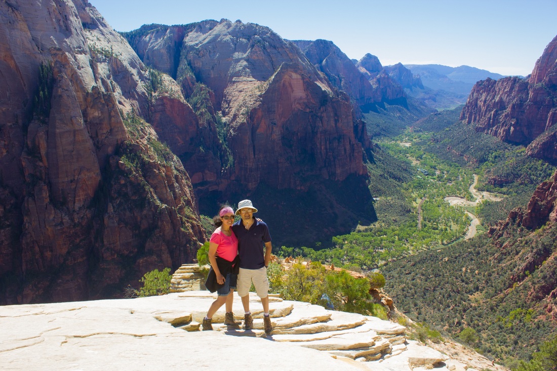
Hands down the best hike of my life!
We were pretty beat by the time we got to the base. We had a good meal and retired for the night.
Day 11 - Zion National Park
Origin: Rockville, UT
Destination: Barstow, CA
Driving distance: 300 miles
Destination: Barstow, CA
Driving distance: 300 miles
The next day we did another of Zion's famous hikes - Zion Narrows. This hike is a water hike where you are hiking in the Virgin River between the Zion canyon.
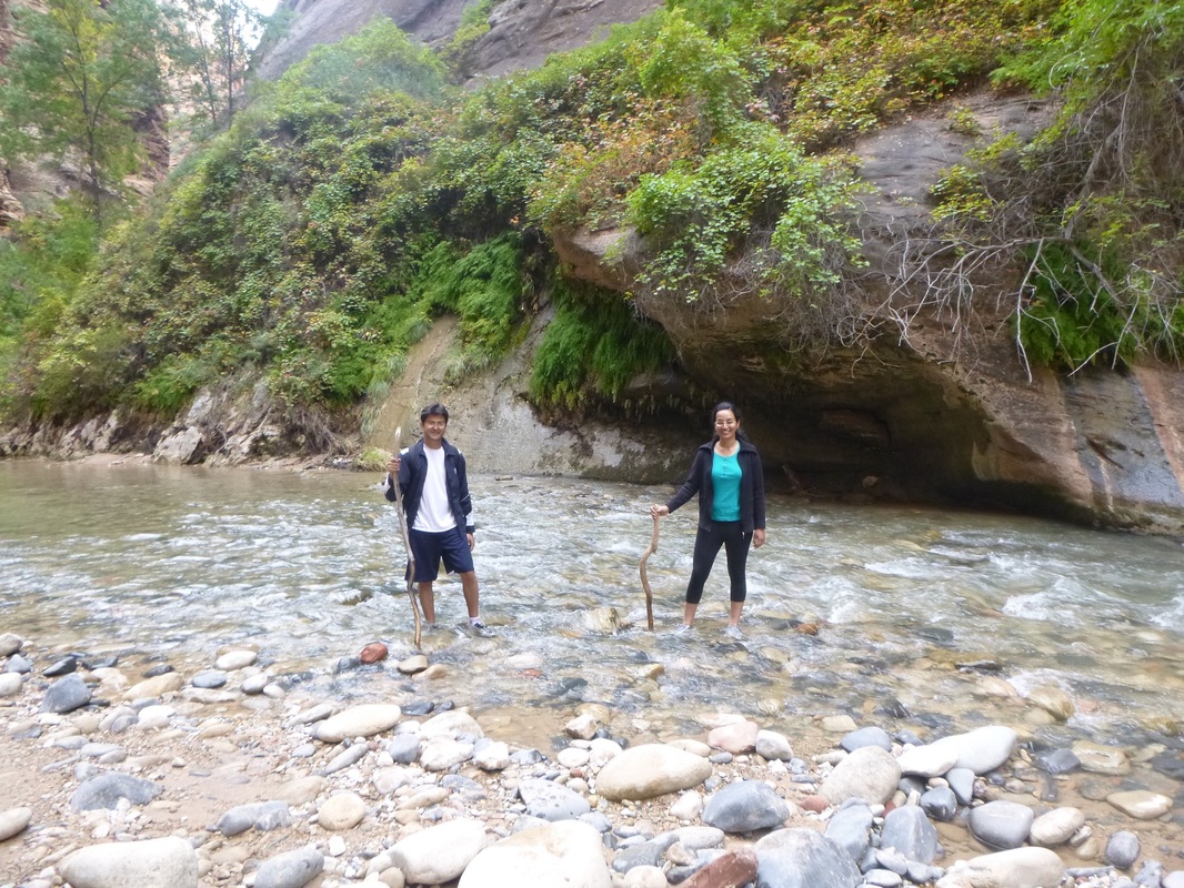
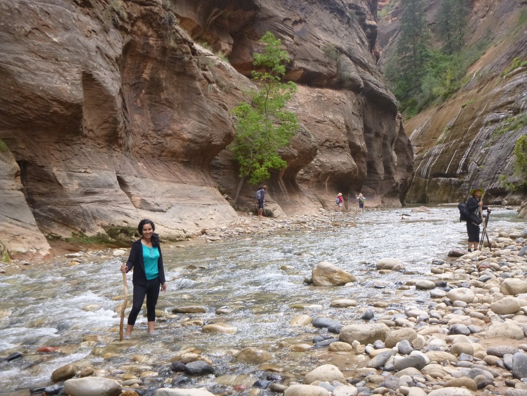

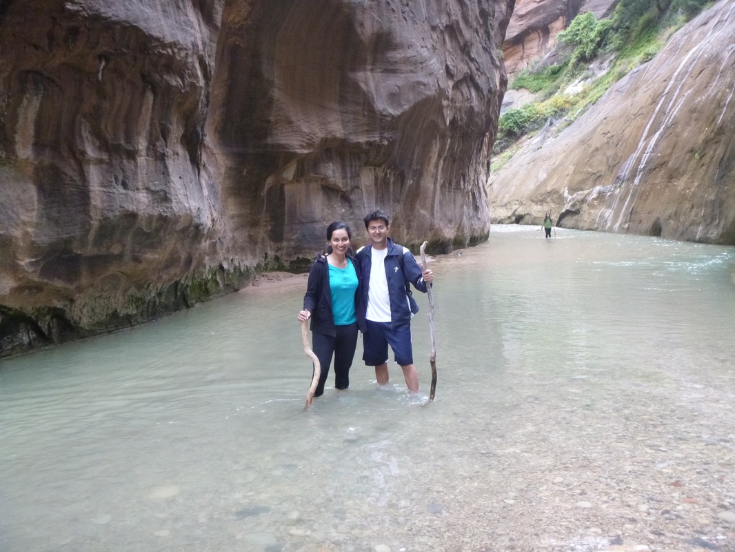
The water can go up waist high, but thankfully the day we were doing it, it come to our knees at most. You can go almost 16 miles up the river, but the water was really cold, so we turned back after a mile or two. Pretty unique hike.
We were done with the hike by lunch time. Since we were done a little earlier than expected, Abhishek asked me if I wanted to go to Vegas! Who says no to such an offer? :) Some pictures of a quick stop at Vegas!
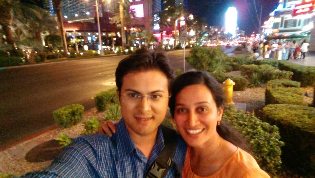
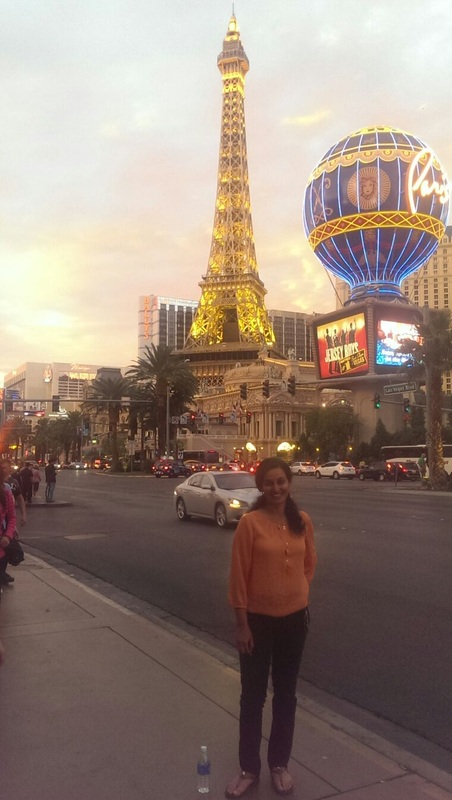
That was our last sightseeing stop on the road trip! With our hearts full, we retired to bed looking forward to getting to our new home on Day 12.
Day 12 - Mountain View
Origin: Barstow, CA
Destination: Mountain View, CA
Driving distance: 380 miles
Destination: Mountain View, CA
Driving distance: 380 miles
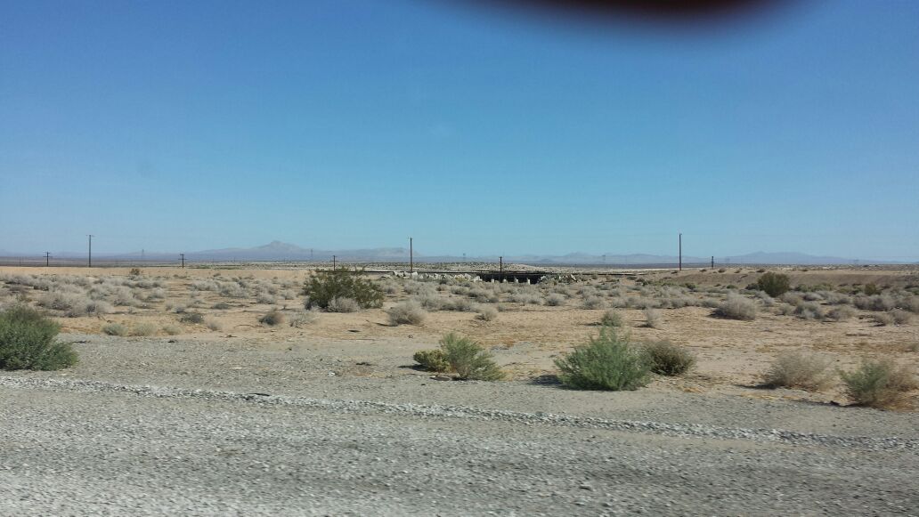
Day 12 was pretty much driving from Barstow to Mountain View. The drive initially was through pretty arid flat lands. Because of the lack of rainfall, it was quite dusty as well.

With a deep tan, and our hearts full, and chatting about our magical moments on the road trip, we arrived safe sound and very happy to Mountain View in the afternoon!
This road trip was such a fantastic experience. We got the see the how the landscape changed across the US - from the hilly regions in the east coast, the flat lands of the midwest, the mountains of Colorado and the desert rock formations of Utah.
We had so much fun doing hikes, talking about random things during the drive, exploring new cuisines and new places. One of the best vacations of my life!
We had so much fun doing hikes, talking about random things during the drive, exploring new cuisines and new places. One of the best vacations of my life!
